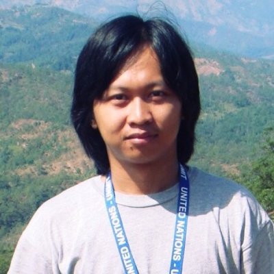
Benny Istanto is a seasoned Geospatial Consultant at Benny Istanto Geospatial Consulting, where he leverages over 15 years of expertise in agricultural meteorology and GIS to deliver innovative solutions for precision agriculture and natural resource management. Based in Bogor, Indonesia, Benny has cultivated a robust...
Benny Istanto is a seasoned Geospatial Consultant at Benny Istanto Geospatial Consulting, where he leverages over 15 years of expertise in agricultural meteorology and GIS to deliver innovative solutions for precision agriculture and natural resource management. Based in Bogor, Indonesia, Benny has cultivated a robust portfolio working with the United Nations and various international organizations, focusing on integrating advanced GIS modeling with climate technology to enhance international development initiatives. His proficiency in remote sensing and information management enables him to provide tailored consultancy services that address the unique challenges faced by farmers and resource managers in the region.
Currently, Benny is engaged in several key projects that exemplify his commitment to sustainable agricultural practices and environmental stewardship. One notable project involves the development of a geospatial framework for monitoring crop health and yield predictions, utilizing satellite imagery and spatial modeling techniques. This initiative not only aids farmers in optimizing their agricultural practices but also contributes to food security in the region. Additionally, Benny is exploring the application of numerical simulation models to assess the impacts of climate variability on agricultural productivity, providing stakeholders with actionable insights for better decision-making.
Benny's expertise in geovisualization and programming further enhances his ability to communicate complex data in an accessible manner, ensuring that clients can effectively utilize the information for strategic planning. As a certified GIS Professional (GISP), he remains at the forefront of technological advancements in the field, continuously seeking innovative ways to apply GIS and remote sensing in atmospheric science and climatology. Through his consultancy, Benny Istanto is not only shaping the future of geospatial applications in agriculture but also fostering a deeper understanding of the interplay between climate and land use in Indonesia.


